
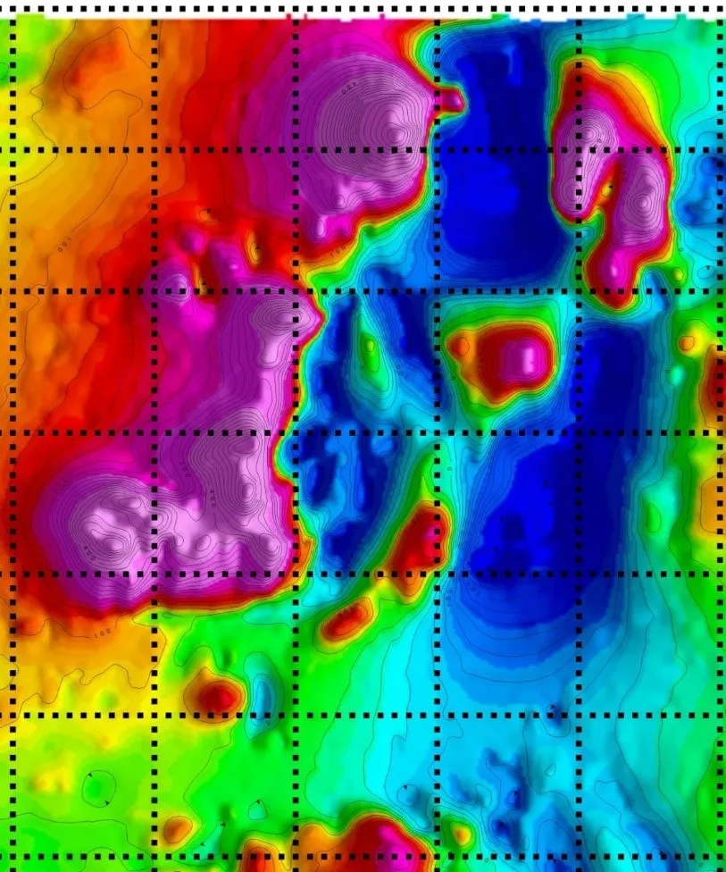
Flagship · AI Prospectivity
CAGE-IN Mineral Prospectivity
AI-driven mineral targeting from the data you already own.
The Problem
Your legacy data is a national asset. Unlock more of it, faster.
Exploration companies and geological surveys hold decades of satellite imagery, geochemistry, geophysics, and drill data — investments that have cost tens of millions to acquire. Modern AI methods can extract significant additional value from those assets, but manual re-interpretation pipelines take a 3–5 person team six to twelve months per project. CAGE-IN compresses that work to weeks, so the value of the data flows through to ranked targets at the pace today's exploration cycle requires.
What we built
How CAGE-IN solves it
- → Integrates satellite imagery with structural geology, lithology, aerogeophysics, and geochemistry — all in one pipeline
- → Reasoning flowsheet built from experienced geologists' actual thought processes, enriched by peer-reviewed publications
- → Geological logic stays current — new research feeds back into the model as the literature evolves
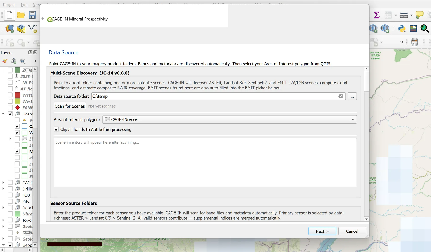
- → Supports ASTER, Landsat 8/9, Sentinel-2, and EMIT L2A/L2B with automatic cloud, SWIR, and metadata discovery
- → AoI-driven clipping integrated with your QGIS polygons, so processing scales to budget
- → Outputs are prospectus-ready: ranked targets with confidence scoring, packaged for FDI attraction
The outcome
A ranked portfolio of 200+ targets in weeks, not years — reasoned the way a senior exploration geologist would, then scaled across an entire licence area.
Inputs
Satellite imagery (ASTER, Landsat 8/9, Sentinel-2, EMIT L2A/L2B) · Structural geology · Lithology maps · Aerogeophysical surveys · Geochemistry · QGIS AoI polygon
Outputs
Ranked target portfolio with confidence scoring · Composite score raster · Anomaly polygons (GeoPackage) · Three probability surfaces · Conflict Map · RGB composites · Crosta PCA images · QGIS-loaded layers with symbology · Prospectus-ready maps
Deployment
QGIS Processing plugin
Version v1.0.0 (codename Garud · Apr 2026)
How it Works
Three engines, one ranked output.
CAGE-IN combines three independently-developed scoring engines that each approach the prospectivity question from a different mathematical standpoint. Method A is a weighted linear combination engine incorporating twelve deposit models and a twelve-criterion consistency veto filter — built on the published geological reasoning frameworks for each commodity system. Method B is a Random Forest classifier trained with spatial-block cross-validation, preserving spatial autocorrelation during hold-out. Ensemble Fusion merges the two method outputs via Dempster-Shafer evidence theory, producing a conflict-aware composite score that surfaces areas of genuine agreement and flags areas of methodological disagreement for geologist review. Each engine is named openly. The weights, rules, and mathematical implementation are proprietary.
Method A
Weighted Linear Combination
A twelve-deposit-model knowledge engine with a twelve-criterion consistency veto filter. Encodes the geological reasoning of experienced exploration geologists, calibrated against peer-reviewed deposit literature.
Method B
Random Forest
A supervised machine learning engine with spatial-block cross-validation — preserving spatial autocorrelation during hold-out to produce unbiased prospectivity estimates over large licence blocks.
Ensemble Fusion
Dempster-Shafer Evidence Fusion
Merges Method A and Method B outputs into a conflict-aware composite score. High-agreement zones surface as high-confidence targets; disagreement zones are flagged explicitly for geologist review.
Sensors & Indices
Six sensors. Twenty-one indices. Twenty-eight composites.
ASTER
Thermal infrared and SWIR bands for hydrothermal alteration mapping, with TIR substitution logic for EMIT hyperspectral scenes.
Landsat 8 / 9
L2SP surface-reflectance product for iron-oxide, clay and carbonate indices across multidecadal time series.
Sentinel-2
L2A 10 m resolution for high-density spectral alteration analysis and vegetation masking at field scale.
EMIT L2A / L2B
Spaceborne imaging spectrometer delivering 285-band hyperspectral coverage — mineral abundance maps at 60 m resolution.
PALSAR SAR
L-band synthetic aperture radar for structural lineament detection through cloud cover and dense canopy.
EnMAP
German hyperspectral mission providing 224 bands (420–2450 nm) for detailed mineralogical fingerprinting in critical-mineral terrain.
21 spectral alteration indices feed 28 composite pre-computations across six evidence families: spectral, geophysics, terrain, geology, geochemistry, and EMIT-specific hyperspectral evidence.
Deposit Models
Twelve deposit models. Calibrated against peer-reviewed literature.
Porphyry Cu-Au-Mo
ValidatedEpithermal Au-Ag (HS + LS)
ValidatedIOCG
ValidatedSkarn Au-Ag
ValidatedIntrusion-Related Gold (IRG)
ValidatedLaterite Ni
ValidatedNi Sulphide (magmatic)
ValidatedSEDEX polymetallic
ValidatedOrogenic Au (incl. Carlin-type)
ValidatedMetamorphic Graphite
ValidatedVMS
ValidatedDiamond Kimberlite (pipe)
ValidatedEach model is calibrated against the published prospectivity and deposit-characterisation literature for that system — including alteration zonation, structural controls, and geochemical pathfinder signatures. No specific weight values are published.
Performance
Production-grade compute.
CAGE-IN runs on hardware-adaptive GPU tiling via CuPy — scaling to available VRAM and falling back to CPU tiles automatically. Numba JIT compilation drives spectral index computations at measured speedups over pure Python.
13.6×
Numba acceleration
Measured speedup over pure-Python baseline across spectral index computations.
2–5 min
Per 1,000 km²
Scene throughput at 10,000-pixel Sentinel-2 tiles on GPU-tiled CuPy pipeline.
220+
Regression tests
Production-grade test suite covering spectral, geophysics, terrain, geology and geochemistry families.
50–70%
VRAM safety margin
Hardware-adaptive GPU memory scheduling with automatic tile fallback on OOM.
Validation
Cross-validated across four continents.
Nevada, USA
Blind prospectivity scoring recovered known Carlin-type district footprint from multisource spectral-structural evidence, without prior geochemical input.
Titiribi, Colombia
Method A and Method B ensemble independently ranked the principal alteration envelope — confirming porphyry structural controls at regional scale.
Rajasthan, India
Integrated structural, spectral and statistical evidence surfaces to produce a predictive prospectivity model across a large Precambrian craton transect.
Uganda (greenfield)
Cold-start run on a licence block with no prior exploration history delivered a ranked target portfolio within the project timeline — validated against subsequent field check results.
Documented validation reports for each terrain are available on request. Contact us to arrange a technical review session.
Living Methodology
AI-backed fluid software.
The positioning
Our tools are not static models frozen at training time. Their geological reasoning evolves as the field evolves — new peer-reviewed publications refine deposit models, new interpretation methods sharpen existing analyses, and new mineral discoveries open new deposit categories. The software updates with the science.
New publication
→ deposit model evolves
New interpretation method
→ analysis sharpens
New mineral discovery
→ deposit category opens
Methodology Citations
Built on the peer-reviewed literature.
CAGE-IN's deposit models are calibrated against the published prospectivity literature. Selected references:
- → Lowell & Guilbert 1970 — Lateral and vertical alteration-mineralization zoning in porphyry ore deposits. Economic Geology.
- → Singer, Berger & Moring 2008 — Porphyry copper deposits of the world: database and grade and tonnage models. USGS Open-File Report.
- → Osinowo, Olayinka, Olayiwola et al. 2021 — Hyperspectral signatures of hydrothermal alteration in mineral exploration. Remote Sensing Applications.
- → Crosta, Sabine & Realmuto 2003 — Mineralogical mapping in the northern Chilean Andes using co-orbital ALI, ASTER and Hyperion data. International Journal of Remote Sensing.
- → Rajendran & Nasir 2017 — ASTER capability in mapping of mineral resources of arid region: A review on mapping of mineral resources. Ore Geology Reviews.
- → Drury & Hunt 1988 — Remote sensing of lithological and structural controls in mineral exploration — an overview. Episodes.
- → Serwa & Elbialy 2021 — Modern alteration mapping techniques using Landsat-8 and ASTER satellite data. Egyptian Journal of Remote Sensing and Space Sciences.
The full citation list from the CAGE-IN codebase is available on request. Contact us to discuss any specific publication or methodology question.
The Landing Page
See it for yourself.
Free Consultation
See what CAGE-IN finds in your licence area.
Book a 30-minute technical call with Dr. Amit Tripathi. Bring your area of interest — we will walk through what CAGE-IN would ingest, how the three engines would score it, and what an output portfolio looks like in QGIS. No commitments.
No commitments · Results-as-a-Service terms available · 48-hour reply
Also from AIRE
Other tools in the stack
Production · 3D Prospectivity
Bhumi3DMapper
3D mineral prospectivity for working geologists — no command line, no Python team.
Production · Data Ingestion
Batch GIS Loader
Turn legacy data rooms into a working QGIS project in minutes.
In Development · Regional Reconnaissance
OmniMiner
Regional mineral reconnaissance from satellite imagery — spectral analysis for working geologists.
In Development · AI Researcher
Varahmihir
AI research extraordinaire — before you spend a rupee in the field.