
Production · Data Ingestion
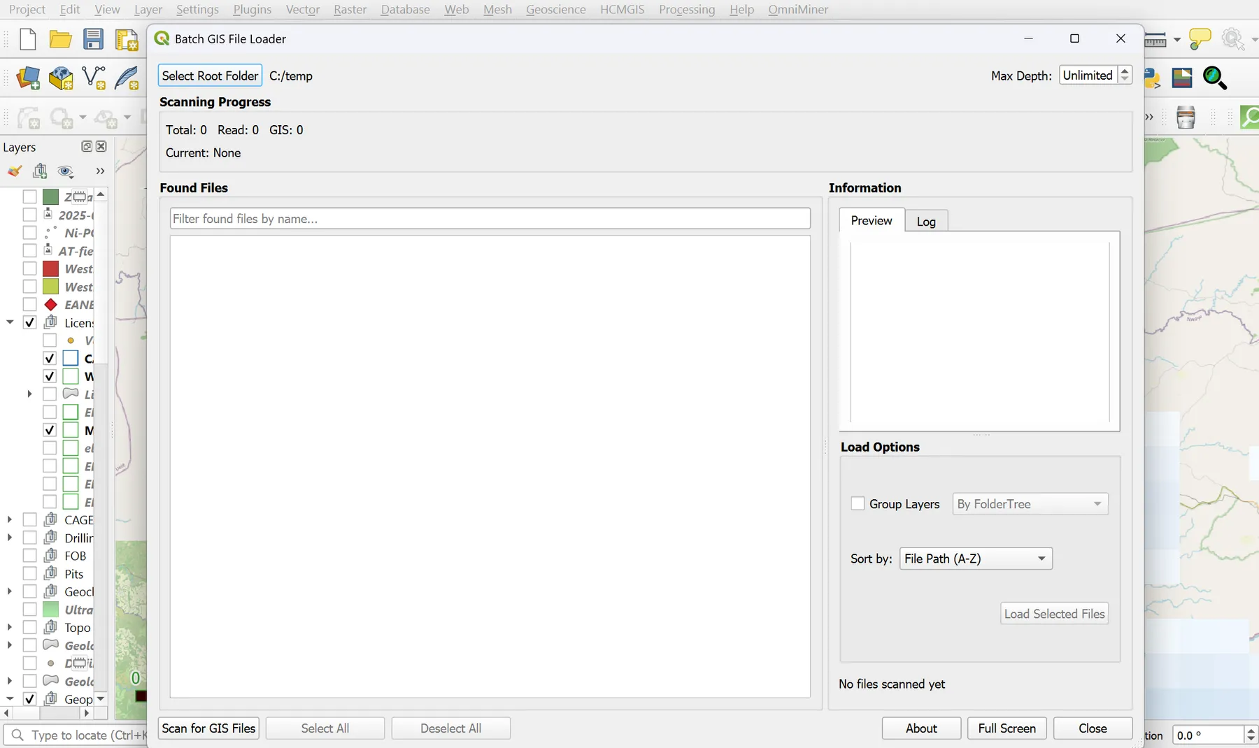
Batch GIS File Loader
Turn legacy data rooms into a working QGIS project in minutes.
The Problem
Inheriting a project means inheriting a data graveyard.
Take over an exploration project, an M&A target, or a government data dump and you get tens of thousands of files — shapefiles, GeoPackages, GeoTIFFs, KMLs, DXFs — buried across dozens of legacy folder structures. Loading them into QGIS by hand costs analyst-weeks, breaks on broken files, and you still miss things.
What we built
How Batch GIS Loader solves it
- → Recursive scan across the entire folder tree, with configurable max-depth
- → 20+ vector and raster formats — every file is validated before it touches QGIS
- → Inline preview panel: CRS, geometry, feature count, extent, band info — for any file in the list
- → Filter, search, drag-and-drop folders, and selectively group layers by FolderTree, Subfolder, or Type
- → Progress tracking with cancellation; safe handling of permission errors and broken files
The outcome
A populated, grouped, symbolised QGIS project in minutes. Production-deployed at AIRE on every new client engagement.
Inputs
Any folder tree — exploration data rooms, M&A diligence packets, government data archives
Outputs
QGIS layers grouped per your chosen scheme, with progress tracking and full cancellation
Deployment
QGIS plugin · QGIS 3.40+
Version v1.0
The Landing Page
See it for yourself.
Free Consultation
Curious if Batch GIS Loader fits the work you do for your clients?
Book a 30-minute discovery call with Dr. Amit Tripathi. We will look at what you are delivering today, where these tools could give you leverage, and how a partnership could work — at no cost.
No commitments · White-label terms available · 48-hour reply
Also from AIRE
Other tools in the stack
Production · 3D Prospectivity
Bhumi3DMapper
3D mineral prospectivity for working geologists — no command line, no Python team.
In Development · Regional Reconnaissance
OmniMiner
Regional mineral reconnaissance from satellite imagery — spectral analysis for working geologists.
In Development · AI Researcher
Varahmihir
AI research extraordinaire — before you spend a rupee in the field.