
Production · 3D Prospectivity
Bhumi3DMapper
3D mineral prospectivity for working geologists — no command line, no Python team.
The Problem
Modern 3D prospectivity scoring shouldn't require hiring a Python team.
Multi-criterion 3D prospectivity modelling — the kind that integrates litho-structural patterns, alteration signatures, gravity gradients, magnetics, and known mineralisation envelopes — has historically meant a 6–8 week engagement with geostatisticians and a custom code pipeline per deposit. Most exploration teams have geologists, not software engineers.
What we built
How Bhumi3DMapper solves it
- → Two purpose-built models: Proximity (resource delineation, 11 criteria) and Blind (greenfield step-out, 10 criteria) in the same run
- → Pure-Python computation core — fully tested, deposit-agnostic, runs on the geologist's laptop
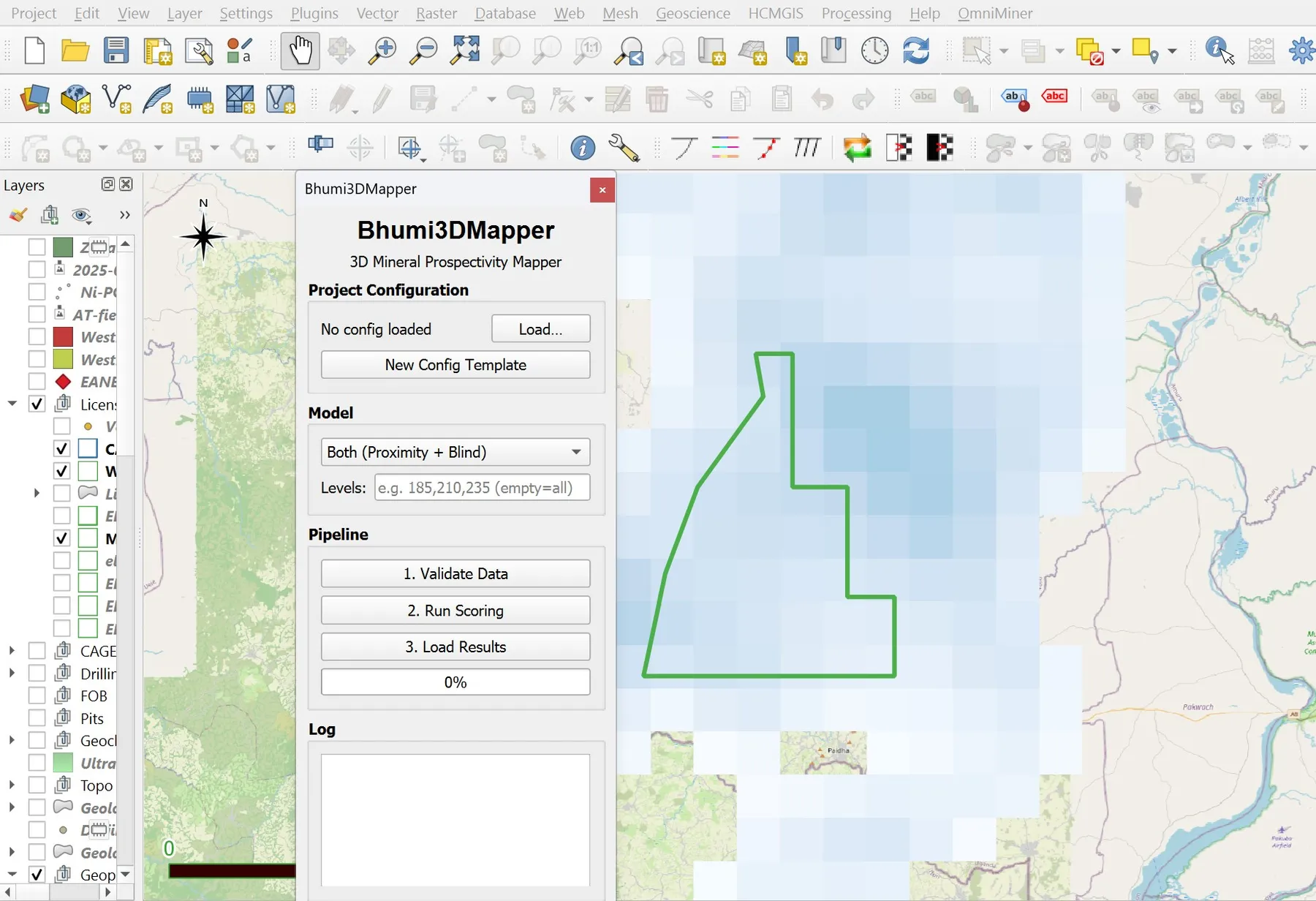
- → Five clicks: load → score → write GeoPackages → build voxel → load with colour-coded QGIS symbology
- → Stacked 2D GeoPackages per mRL level for fast QGIS rendering; optional 3D voxel for cross-level novelty analysis
- → Adapts in two file edits — SEDEX Pb-Zn, VMS, porphyry, epithermal — without touching the engine
The outcome
A scored 3D prospect map in hours instead of months. Geologists keep ownership of the workflow. The plugin already covers 50M cells in a typical run.
Inputs
Drill collars + litho/assay CSV · Gravity & magnetic susceptibility inversion TIFs · Known ore polygons (GPKG) · Project config JSON
Outputs
Stacked 2D prospectivity GeoPackages (one per mRL level) · Optional .npz voxel · QGIS symbology files
Deployment
QGIS Processing plugin · QGIS 3.28+ · Qt5/Qt6 compatible
Version v1.0.0
The Landing Page
See it for yourself.
Free Consultation
Curious if Bhumi3DMapper fits the work you do for your clients?
Book a 30-minute discovery call with Dr. Amit Tripathi. We will look at what you are delivering today, where these tools could give you leverage, and how a partnership could work — at no cost.
No commitments · White-label terms available · 48-hour reply
Also from AIRE
Other tools in the stack
Production · Data Ingestion
Batch GIS Loader
Turn legacy data rooms into a working QGIS project in minutes.
In Development · Regional Reconnaissance
OmniMiner
Regional mineral reconnaissance from satellite imagery — spectral analysis for working geologists.
In Development · AI Researcher
Varahmihir
AI research extraordinaire — before you spend a rupee in the field.