What We Offer
Our Services
End-to-end mineral exploration consulting — from reconnaissance to resource estimation, and everything in between.
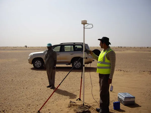
Mineral Reconnaissance
Remote sensing and field verification-based geological mapping of large areas to identify prospective targets for further investigation.
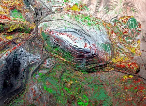
GIS Integration
Integrating data from multiple sources into a single unified database, enabling comprehensive spatial analysis across all exploration datasets.
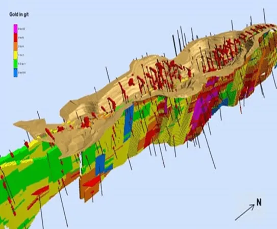
Turnkey Exploration & Resource Modelling
High-resolution mapping, sampling, and geophysics combined with predictive modelling and drill planning. Full drilling management including logging, sampling, QA-QC, cross sections, and resource models.
Exploration Technologies
Developing and deploying proprietary technology tools for efficient, AI-driven, and eco-friendly exploration — increasing process efficiency while reducing environmental impact.
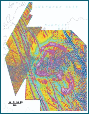
Integrated Data Interpretation
Proven proprietary technology for integrating historical data, known mineralization data, and geological and geophysical datasets for precise mineral targeting over large areas.
Mineral Intelligence
Remote sensing and drone-based surveys of mining areas for change detection of toxic pollutants, illegal mining activities, and production monitoring.
Mineral Policy Matters
Tracking policies and regulatory frameworks of countries that have successfully discovered and developed their mineral resources into productive mines.
Skill Development in Exploration
Capacity building of clients' in-house teams by embedding high-level geological expertise on site — accelerating team capabilities and exploration outcomes.
Mineral Reconnaissance
- Base mapping in Greenfield Exploration
- Lithology and structure mapping at local and regional scale
- Underground geological and structural mapping
- Geochemical anomaly mapping based on assay data
- Mapping alteration signatures relevant to the mineral of interest
- Analysis and interpretation of multiple datasets for target generation
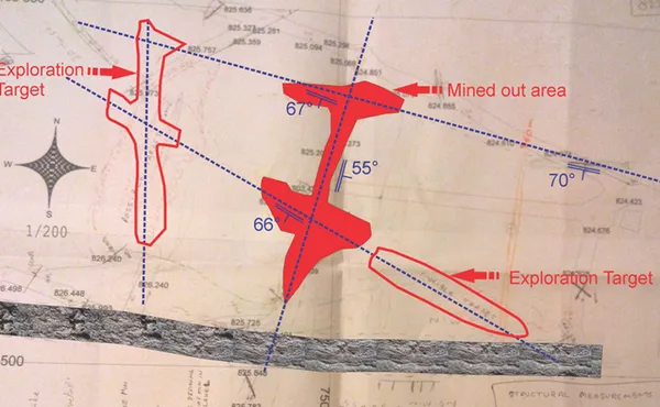
- Establishing structural controls of mineralization in 3D
Turnkey Exploration & Resource Modelling
- 3D modelling of major structures, fracture zones, lithologies, ore volumes, and alteration zones
- Converting the exploration drilling database into 3D models
- Mineralization target generation by litho-structure pattern study in 3D
- Modelling the distribution pattern of ore bodies
- Resource modelling using geological, geochemical and geophysical data
- 3D block modelling for resource estimation
GIS Integration
- Dedicated team highly experienced in satellite data interpretation — including high-resolution and hyper-spectral image interpretation
- Specialist capability in lithostructural interpretation combined with alteration and mineral mapping
- Large portfolio covering a wide range of commodities in diverse geological environments
- High-resolution imagery examination for geological mapping and mine planning
Integrated Data Interpretation
- Processing and interpretation of aeromagnetic and radiometric data to understand mineralization controls
- Integration of RS and geophysical datasets (2D and 3D) for target generation
- Prioritization of exploration targets
- Proprietary CAGE-IN technology for geological and geophysical data integration and enhanced interpretation
Skill Development in Exploration
We build the capacity of clients' in-house teams by embedding high-level geological expertise directly on site. As part of this service, we have developed custom data entry tools with:
- HTML-based tools using CSS / PHP / JS
- Dropdown lists defining permitted values to eliminate operator errors
- Validation rules updated as data is entered
- Operator access restricted to current working files
Work With Us
Discuss Your Project
Contact us to find out how our services can advance your exploration program.
Get in Touch