Our Services
Mapping
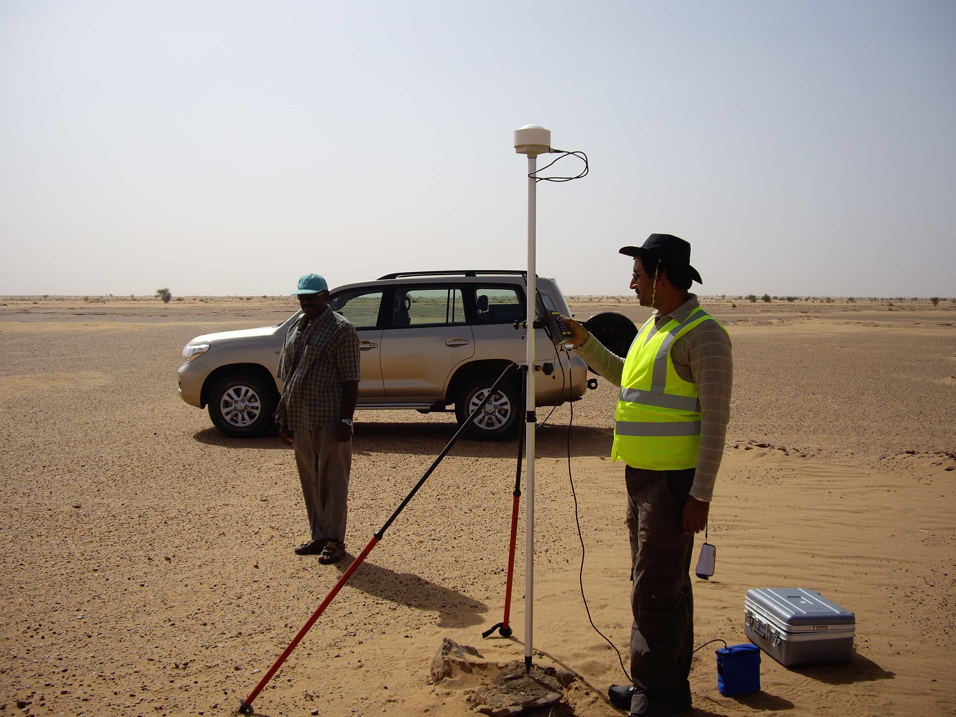
Geological and structural mapping is key component of any mineral exploration program. Our experts use
multiple layers of information about lithological components, structural patterns collected-on-ground
and assessed to understand the litho-structural controls of mineralization.
- Base mapping in Greenfield Exploration.
- Lithology and structure mapping at local and regional scale for defining the controls of mineralization.
- Underground geological and structural mapping.
- Geochemical Anomaly Mapping based of available assay data
- Mapping the alteration signatures relevant to the mineral of interest.
- Analysis and interpretation of the multiple datasets for target generation.
- Establishing structural controls of mineralization in 3D.
Logging and downhole structural studies
We have expert and experienced team that can undertake litho-logging, geotech-logging and structural logging on drill core and establish 3D predictive mineralization model.
- Logging process standardization.
- Lithologging in prescribed templates.
- Mapping the alteration signatures relevant to the mineral of interest.
- Geotechnical RQD / TCR measurements and plotting.
- Measurement of mineralized and barren structures in drill core using α, β measurements and preparing 3D structural fabric maps for defining the controls of mineralization.
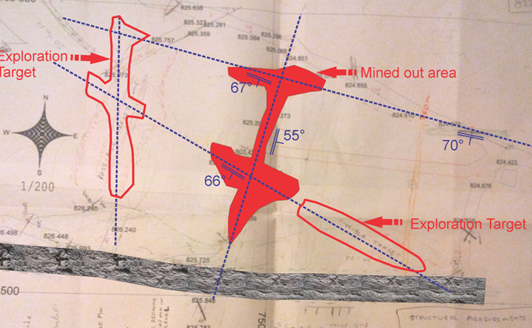
Structural Modelling for Mineral Exploration
- Structural modelling – Leveraging our strength in exploration structural geology for drill target identification and resource modelling
- Controls of mineralization along intersection of structures and strategies for their exploration
- Helped Paxinex, Turkey identify high grade zones in the Adana Zinc mine
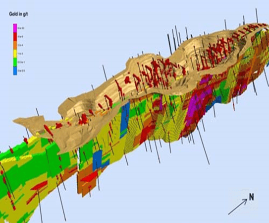
Geostatistics & 3D Modeling
- 3D modelling of major structures, fracture zones, lithologies, ore volumes, country rocks and alteration/mineralization zones.
- Converting the exploration drilling database into 3D Models.
- Mineralization Target Generation by litho-structure pattern study in 3D environment.
- Modelling the distribution pattern of ore bodies in 3D environment.
- Resource Modelling using all aspects of exploration Geological, Geochemical and geophysical.
- Geotechnical and Hydrological Studies in 3D.
- Integrated approach for amalgamation of 2D and 3D datasets.
- 3D Block Modelling.
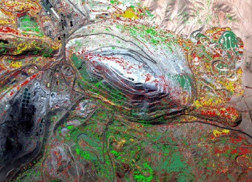
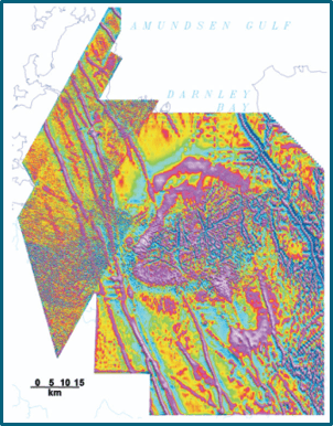
Geospatial (RS/GIS)
- At GeoExploration LLC we have dedicated team of experts who are highly experienced in satellite data interpretation specially high-resolution and hyper-spectral image interpretation.
- With a specialist capability in lithostructural interpretation combined with alteration and mineral mapping we are able to identify targets for field investigation.
- GeoExploration has completed a large portfolio of projects covering a wide range of commodities in an extensive variety of geological and climatic environments.
- A careful examination of high resolution imagery is immensely useful in resolving many of the geological mapping issues, proven to be best tools for mine planning.
Geophysical Data Interpretation
- Processing and interpretation of aeromagnetic and radiometric data to understand mineralization and their controls.
- Integration of RS and Geophysical datasets (2D and/or 3D) for meaningful interpretation target generation based on mineralization and exploration strategies can be formulated.
- Prioritization of exploration targets.
- Properitary CAGE-IN technology for geological and geophysical data integration and enhanced interpretation for target identification.
Data Conversion & Migration
-
Paper / scanned data and maps often contain wealth of information and can add significant value to
and exploration effort. Exploration teams often struggle with digitizing and modelling of these old
reports that can be:
- Historical or paper maps
- Historical paper / scanned geological drill hole logs
- Paper / scanned exploration reports
- We have a capable team that understands exploration and exploration data and can migrate historical data to geological models and block models.
-
We have developed and customized data entry tool as per the specific requirement of the project. The
chief highlights of the tools are:
- HTML tool - Uses CSS / PHP / JS
- Dropdown lists defining permitted values – only permitted data ranges and values can be entered – eliminates operator errors
- Rules to be updated as more data is entered.
- Can capture the data into a XML file for parsing and creating an XLS.
- The operator access is only restricted to the file they are currently working.
Project Advice, Due Diligence and Project Generation
- Identification and prioritization of new projects.
- Technical due diligence on Exploration and Mining projects for takeover, JV or investment.
- Technical and Financial review of projects, companies and proposals.
- Production and development scheduling.
- CAPEX and OPEX (Capital and operational) determinations and optimization.
- Metallurgical test design and sampling.
- Comprehensive database reviews and assurance that data sets are unambiguous, fit-for-purpose and suitable for Mineral Resource Estimation.